Automated
October 10, 2019
New Features, Better Performance, and the Best Visualization Yet!
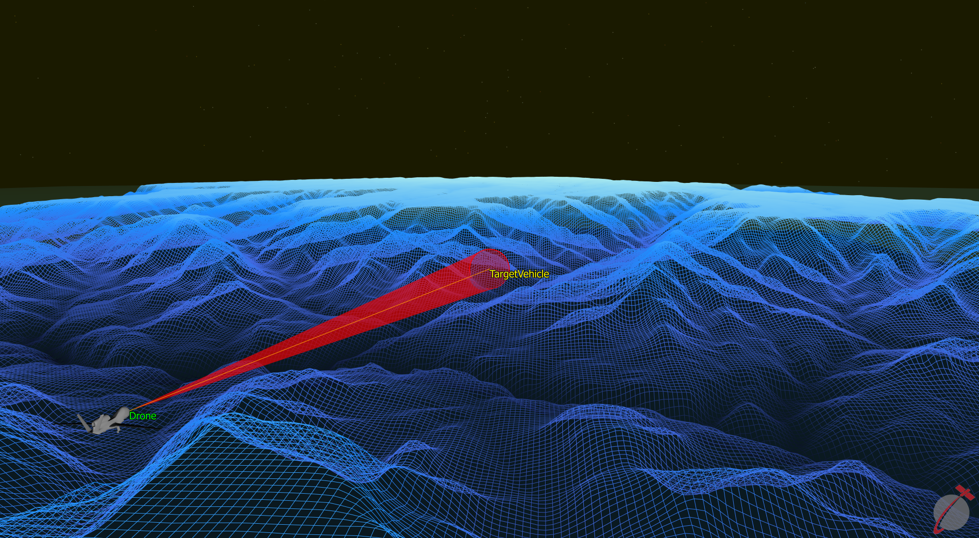
Terrain modeling for line-of-sight analysis, no server required!
- Computes visibility and viewshed between any combination of assets
- Supports most raster terrain file formats
- Terrain can be visualized using PointGroup or GraphicsOverlay objects

FreeFlyer 7.5 Terrain Modeling Feature.
GroundVehicle object models non-orbital vehicles in motion (cars, trucks, drones, etc.)
- Multiple motion models allow flexibility in your modeling
- Perform shadow, geometry, and visibility calculations
FreeFlyer 7.5 GroundVehicle Object Models Drones, Cars, and Tanks.
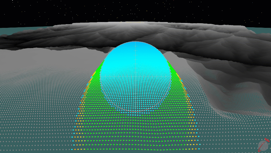
Sensors Added to GroundVehicle Can Compute Coverage.
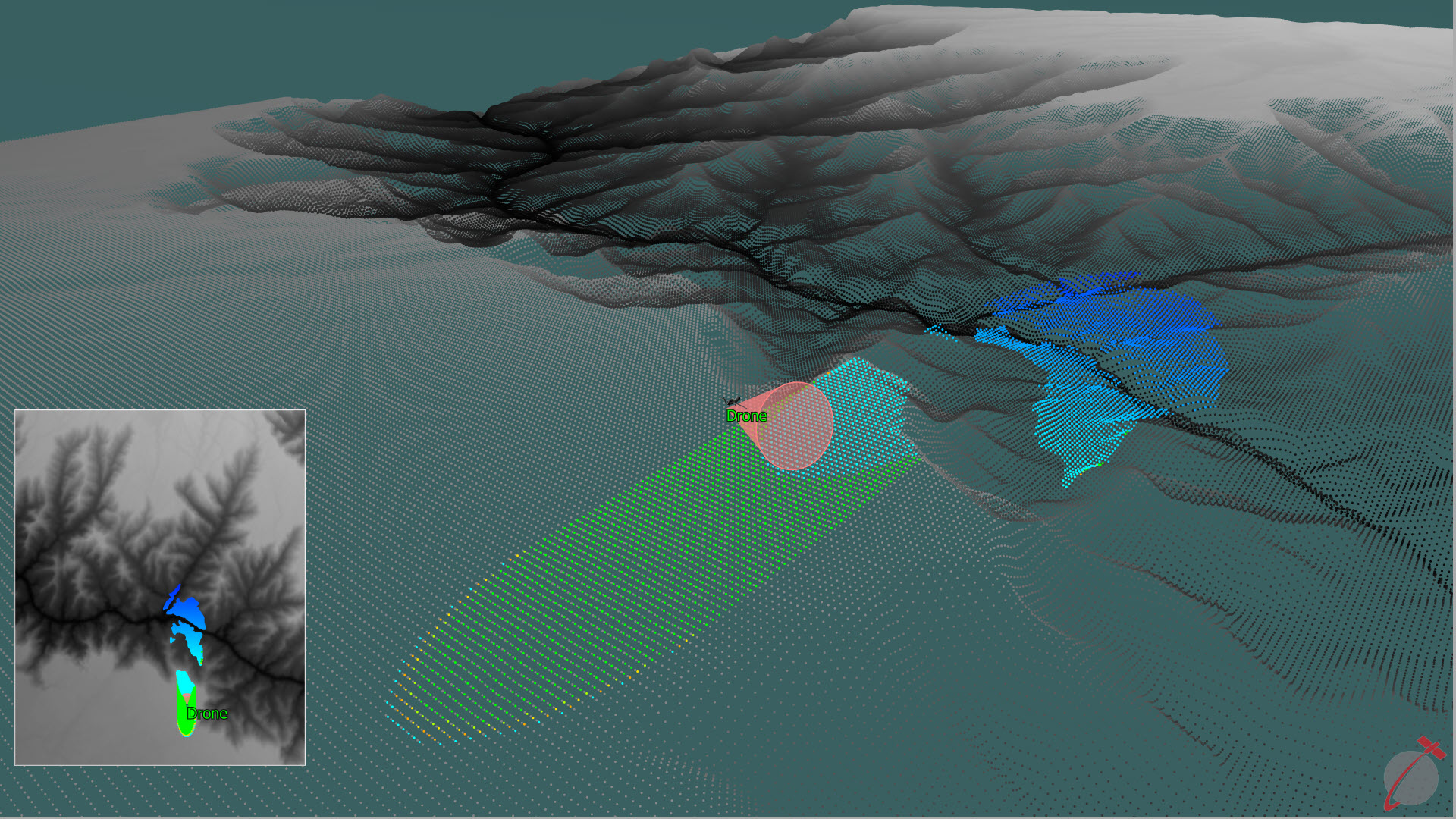
FreeFlyer 7.5 Terrain Viewshed Analysis Feature.
Replay Output Windows
- After a Mission Plan finishes running, replay it backwards and forwards at various user-selectable speeds
- Camera rotation, Viewpoint type changes, and showing / hiding objects are all available while replaying
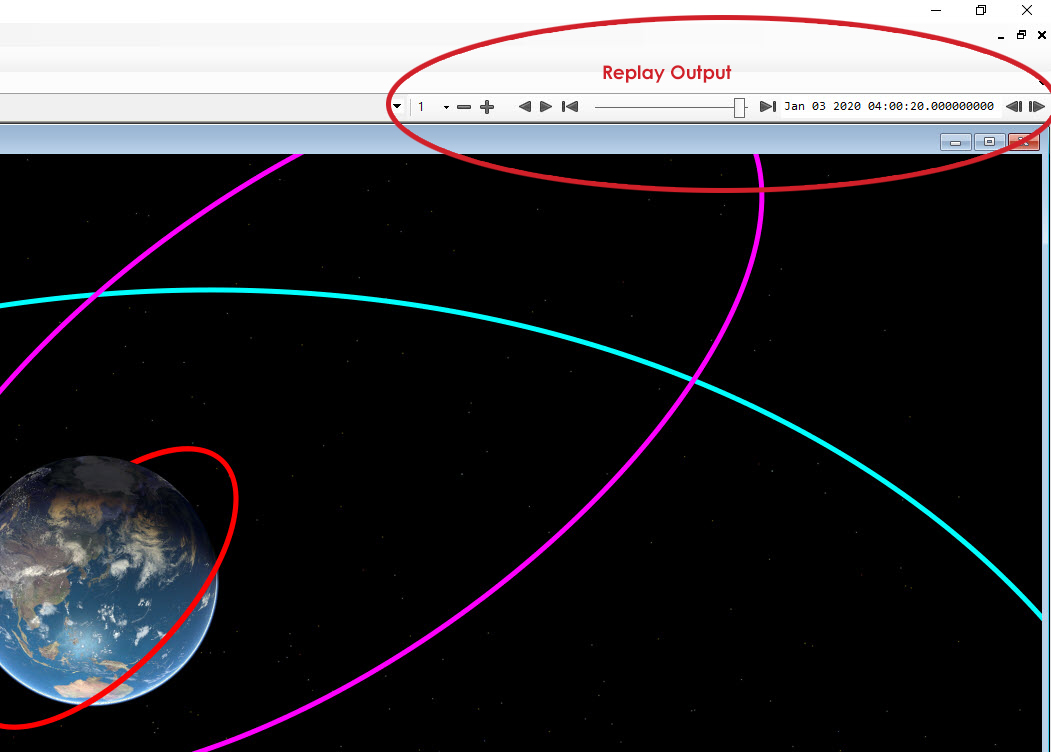
FreeFlyer 7.5 New Replay Controls in Output Workspace.
Other Modeling Enhancements
- New methods make formation modeling easier and more convenient
- Native RIC frame support for attitude and maneuver modeling
- Stability and accuracy improvements when stepping to a condition
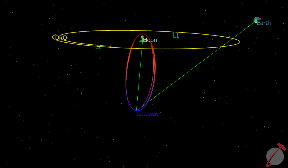
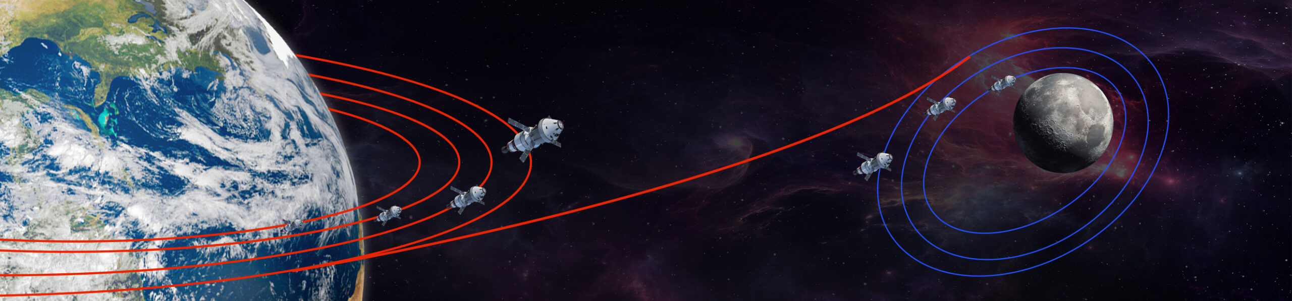
Interplanetary Modeling Simulating Lunar Gateway.
And Much More!
- Matrix objects can now be reported directly for easier use in other tools
- Runtime API Java interface now supports Maven, and Python interface now supports Wheel
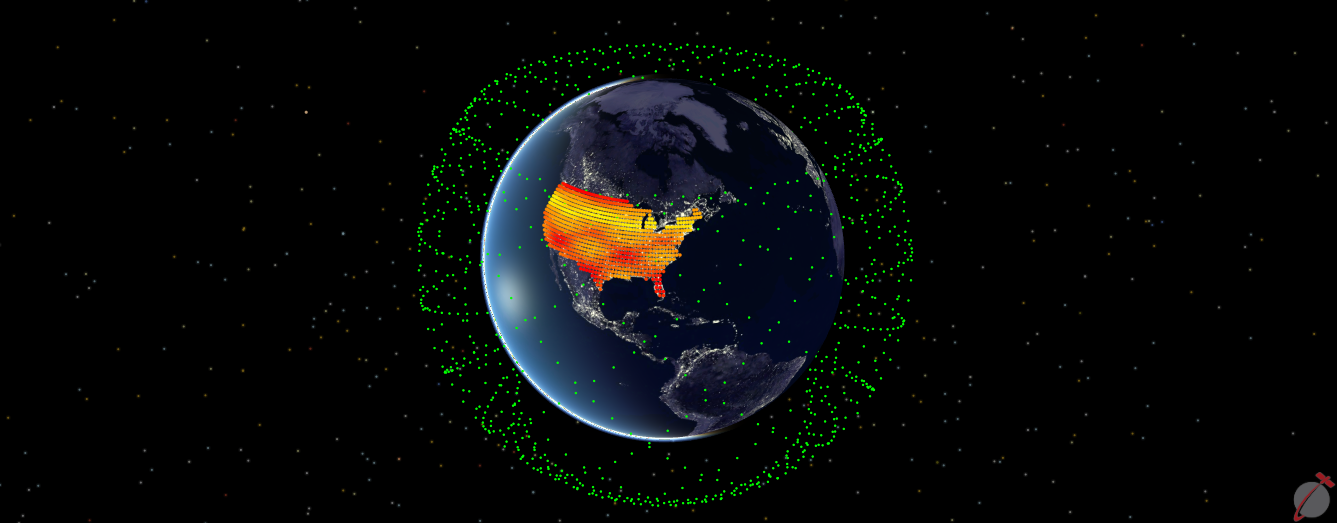
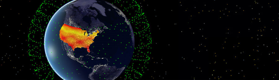
FreeFlyer 7.5 Constellation Modeling is Easier than Ever!
>FREEFLYER 7.5 DETAILED FEATURES DOWNLOAD FREEFLYER 7.5 TODAY!