Description
The Map command displays the specified objects on an equidistant-cylindrical map of the central body in the 2D view mode of a Mission View. The Map command must contain at least one Spacecraft, which specifies the Mission View epoch. For more information, see the Generating Output Guide.
Syntax
Map mySpacecraft; |
Where 800 is the height of the projection of the Region or GroundStation mask
Details
Object types that can be visualized:
•Spacecraft •GroundStation •CelestialObject •Formation •GraphicsOverlay •PointGroup •ProximityZone •Region •RotatingLibrationPoint •Sensor •StarField •Vector •CoordinateSystem |
Other facts:
•Any number and combination of objects can be displayed. •The epoch of the map view is set using the epoch of the first Spacecraft in the list. •A CelestialObject must be listed before any spacecraft that references it. •The texture shown on the central body's surface, and other visualization properties, can be changed through your User Preferences. •A ViewWindow object can be used in place of a Map command. oViewWindows can display different types of Viewpoints. oViewWindows can be updated using the Update command at any point in the Mission Sequence. •In millisecond timing precision mode only, the deprecated "as Global" syntax can be used to update the Map when any spacecraft is Stepped or Maneuvered. oNote that the "as Global" option is scoped to the control statement it was called in. That is to say, when the "as Global" option is used inside of an If block, While loop, or For loop, all steps inside of the control statement will automatically be displayed; any steps taken outside of the control statement will NOT be displayed.
|

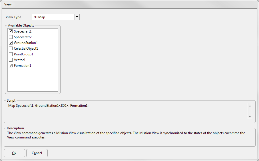
Example 2D Map
Command Editor
Note: To add a Map command via Command Editor, you must start with a View command, then double-click to edit the command, and change its Type to 2D Map.
View Type
Available Objects
•Use the checkboxes to indicate which objects to include in the output view |
Script
•Displays the FreeFlyer Script that is generated by the editor |
Description
•Displays descriptions of the editor and its fields •Description text changes as the mouse pointer moves over the different fields within the editor |
See Also
•View Command
•ViewWindow Properties and Methods
•Generating Output Guide