These sample Mission Plans cover various aspects of Terrain modeling in FreeFlyer. After exploring these Mission Plans, continue to the Terrain guide for more information.
Jump to a Mission Plan Description:
Mission Plan |
Engineer |
Mission |
|
• |
|
|
• |
|
|
• |
|
|
• |
|
|
• |
Drone Tracking a GroundVehicle
This Mission Plan demonstrates the use of the Terrain object for visibility analysis with GroundVehicle objects. Terrain data is used for an area of approximately 0.5 by 1.5 degrees. Visibility analysis is conducted for a drone, a van, a GroundStation (Peterson AFB), and a Spacecraft at GEO (AEHF2).

View of Terrain and contact between GroundVehicles
Grand Canyon GroundVehicle Visibility
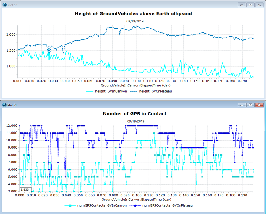
This Mission Plan demonstrates the use of the Terrain object for visibility analysis with GroundVehicle objects. Visibility analysis is conducted between two vehicles on the ground and a GPS constellation overhead.

Plots of GroundVehicle elevation using a refernce terrain and number of GPS satellites in contact
GroundVehicle DoP Calculations
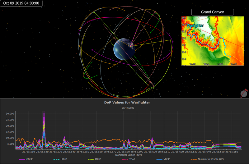
This Mission Plan demonstrates FreeFlyer's capability to be used by a deployed US Army squad to determine their coverage by space assets with respect to the surrounding terrain for upcoming ground operations. In this demonstration a notional ground asset is simulated using a set of GroundVehicle waypoints. After the predicted coverage is computed the information is presented to the user through a variety of formats, including a timeline and 3D and 2D views. This Mission Plan also plots the DoP values for the GroundVehicle over the course of the propagation.
The specific space assets analyzed are pulled from an external file containing a series of two line element sets (TLEs).

GroundVehicle Dillution of Precision calculations
Terrain Viewshed Analysis
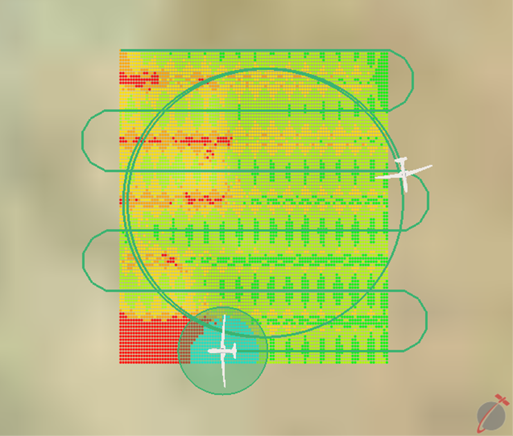
This Mission Plan demonstrates the use of the Terrain object to compute viewsheds. A viewshed represents the set of points that are visible from an observer's location. In this example, the user can select from five different observers: two drone options (line or circular search) and three orbiting satellite options (LEO, GPS, and GEO).
The viewshed is recomputed after each propagation step. Cyan-colored points represent the instantaneous viewshed at the current epoch. Orange, yellow, and green points indicate points that have been seen one or more times by a sensor in the simulation. Red indicates points that have not been seen by a sensor.

Visualization of Drone Viewshed while Flying a Line Search Pattern
Terrain Visualization
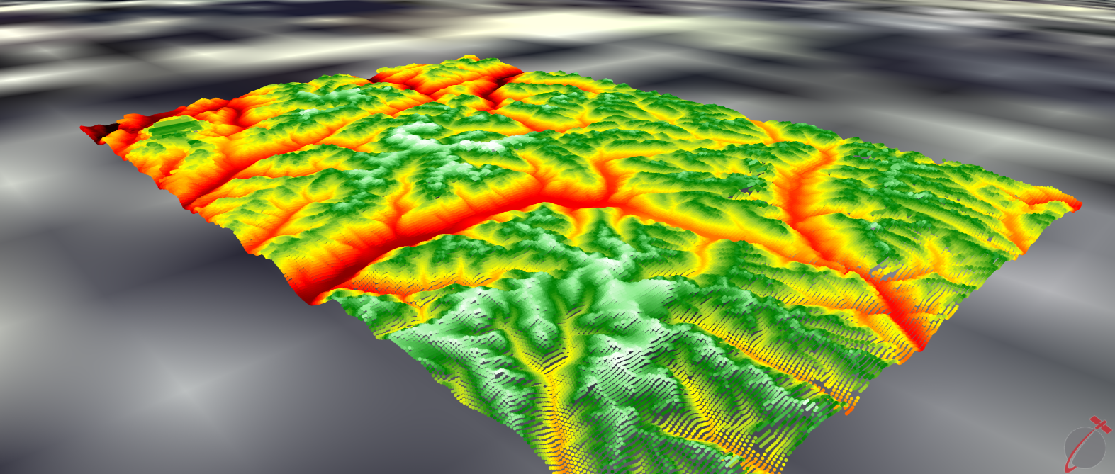
This Mission Plan demonstrates the use of PointGroups and GraphicsOverlays to visualize a terrain data file. If you do not have a terrain data file to load, select 'No' in the first UserInterface and follow the instructions to download a terrain data file from USGS Earth Explorer. Once you have a terrain file downloaded, FreeFlyer will automatically run the freeflyer_terrain_index_generator command line utility to generate an index file. The final output will show either a PointGroup or GraphicsOverlay colored by the height of the data points found within the terrain data file.

Visualization of terrain data file using a PointGroup