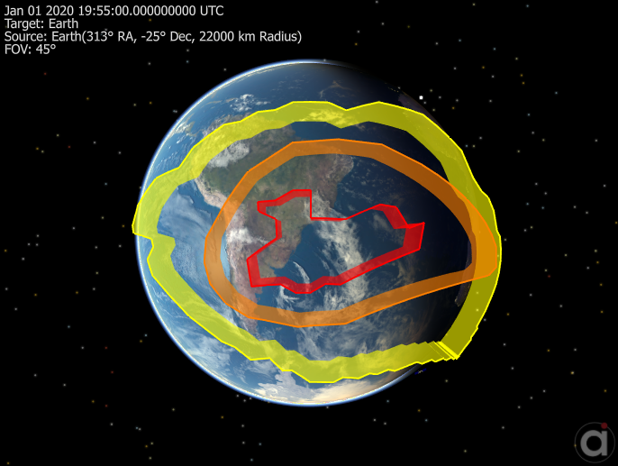
A Region is a closed contour area on a Celestial Object's surface, defined by a series of planetodetic latitude and longitude points (also called vertices). A Region must include at least 4 points and must be a closed polygon, with the same values for the first and last points.
The Region object is used to identify when a Spacecraft is over an area on the surface of a Celestial Object, or when a Spacecraft Sensor "sees" a region. Regions can be viewed in a ViewWindow object or using the View or Map commands. By default, the Central Body of the Region is set to the Earth.
To perform coverage and contact analysis with a Region, you can:
•Use the InRegion flag or ExclusionZone() method to identify when a Spacecraft is over a region. •Use the InView flag or Access() method to identify when a Spacecraft Sensor sees a region. |
The following Sample Mission Plans (included with your FreeFlyer installation) demonstrate the use of the Region object:
|

South Atlantic Anomaly Regions
Example: The InRegion Property
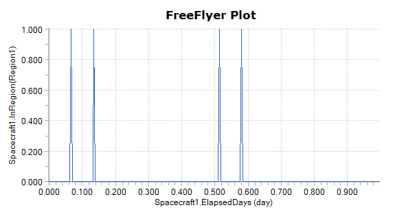
InRegion is a flag that returns a value of "1" when a Spacecraft's sub-satellite point is in a Region and a value of "0" if not in the Region. Similarly, InView returns a zero '0' when a Spacecraft sensor is not in view of Region, and a one '1' when the sensor is in view. The script below creates a plot output of the InRegion flag. For a summary of the coverage and contact output methods in FreeFlyer organized by observer and target object type, see the Contact Method Summary.
Region Region1;
While (Spacecraft1.ElapsedTime < TIMESPAN(1 days)); View Spacecraft1, Region1; Plot Spacecraft1.ElapsedTime.ToDays(), Spacecraft1.InRegion(Region1); Step Spacecraft1; End; |
Note: As of FreeFlyer 7.3, the default timing precision mode is nanosecond precision mode. For older Mission Plans that have not yet been converted from millisecond precision mode, the syntax for working with times is different. See the timing precision mode page for more information.

See Also
•Region Properties and Methods